

Aerial photos of how it was in 1941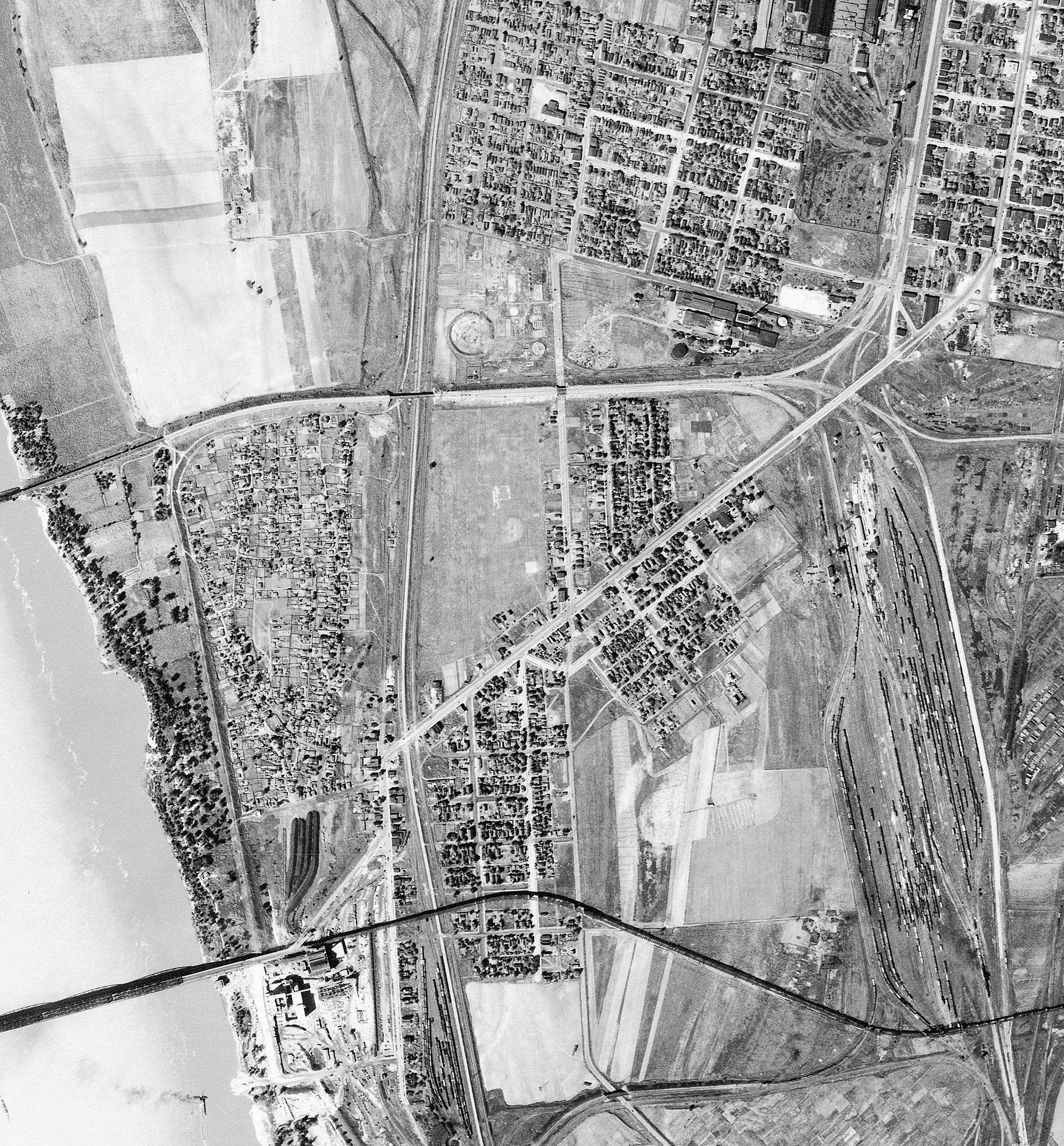
The "Why" behind the aerial photography On May 12, 1933, President Franklin D. Roosevelt signed into law the Agricultural Adjustment Act. This law was originally administered by the U.S. Department of Agriculture, Agricultural Adjustment Administration (USDA-AAA), and today the USDA-AAA is known as the USDA Farm Service Agency.
For a large version of the Venice photo, click HERE. For a large mosaic of the entire Tri-City area photo, click HERE. (When either large photo appears, you can RIGHT CLICK on it and save so you can zoom in even more) Since the mid 1930s, the USDA-AAA and subsequently the USDA-FSA have periodically acquired nationwide aerial photography. Acquired on a county-by-county basis, this aerial photography was first used by the USDA to assess the nation's agricultural lands by estimating cropland acreages from measurements taken on the photographs. USDA-AAA aerial photography also served as the basis for the first national soil surveys.
In Illinois, first-time statewide coverage of USDA-AAA aerial photography was achieved between 1936-1941. This aerial photography is widely recognized in Illinois as a unique resource that represents the earliest photographic record of the cultural and physical landscape features of the entire state.
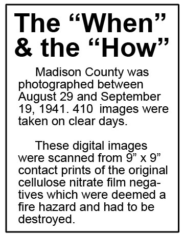
It is intensively used by government agencies, surveyors, planners, consulting scientists and engineers, and other individuals for diverse purposes ranging from determination of past land uses to providing the basis for needs assessment studies in ecological restoration. In Illinois, this USDA photography between the years of 1936-1941, is estimated to be 33,066 photographs. When the original 9"x 9" and 7"x 9" cellulose nitrate film negatives for these photographs were deemed a fire hazard, they were transferred to the National Archives and Records Administration in the 1960s and eventually destroyed, and high-quality photographic paper prints remain as the only physical record. Public access and continual use of library print collections for several decades has resulted in a significant number of the photographs becoming defaced, faded, worn, or lost. The Illinois State Library (ISL), the Illinois State Geological Survey (ISGS), and other libraries have collaborated on scanning these photographs in order to complete a digital archive that will provide a comprehensive photographic record of the early twentieth century for the entire state. As a result of previous contracts and grants, more than one-half of the print collection has already been digitized, and on-line Internet access is available at the Illinois Historical Aerial Photography (ILHAP) web site http://clearinghouse.isgs.illinois.edu/data/imagery/1937-1947-illinois-historical-aerial-photography . Once a statewide digital archive is established, it will reduce and eventually eliminate the need for patrons to regularly handle the original paper prints. Furthermore, placing the digitized photographs on-line ensures the most widespread access to potential user groups and reduces the pressure on the print collections residing at libraries within the state. Digitization of this collection was developed pursuant to a Library Services and Technology Act (LSTA) grant awarded by the Illinois State Library, an Office of the Secretary of State using funds provided by the U.S. Institute of Museum and Library Services under the provisions of the Library Services and Technology Act . Click HERE for the Madison County aerial photos web page. You can view the Illinois Archives page and select another county HERE.
|
Route 66 east of Chain of Rocks Bridge circa 1941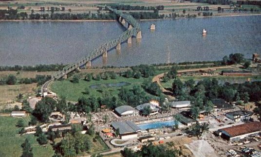
This photo of the Chain of Rocks Bridge got me thinking: It looks like Route 66 makes a turn to the left in the distance. Where did it go from the east end of the bridge. I wanted to know.
Route 66 was first routed across the Mississippi River in 1926 across the McKinley Bridge from Venice to St. Louis. This continued for the first three years of the "Mother Road's" existence. In 1929, Route 66 was rerouted - from Madison Avenue and Broadway then south on Fourth Street to East St. Louis and across the MacArthur Bridge - to the Chain of Rocks Bridge (with the 22-degree turn!). Route 66 ran west through Edwardsville then down the hill by the cemeteries (now IL Rte 157) and continued (across the now road to SIUE) into Mitchell. It passed Zane Miller's house and eventually the infamous Luna Cafe and the original St. Elizabeth Church (where Fr. Peter Kaenders once pastored), but then where? It did not go around the left curve and down Nameoki Road (Rt 203) like we do today. In 1935 Route 66 was routed across the Chain of Rocks Bridge until 1955. So where did it go and how did it hook up with the "bent" bridge? Below is a mosaic of 1941 aerial photos of Madison County. The route is quite different from what exists today.
Old Route 66 The above mosaic is made from U.S. Department of Agriculture aerial photographs taken in 1941. It shows approximately 10 miles of U.S. Route 66 from near Chain of Rocks Park to the Sunset Hills Cemetery. For a very large annotated version of this Route 66 photo, click the photo above. It's BIG and could take a while to load. You also may have to wait for it to clear up when you zoom. |

)